
GPS Coordinates
by Δημήτρης Γεωργιάδης
🗂️ Tools

Features GPS Coordinates
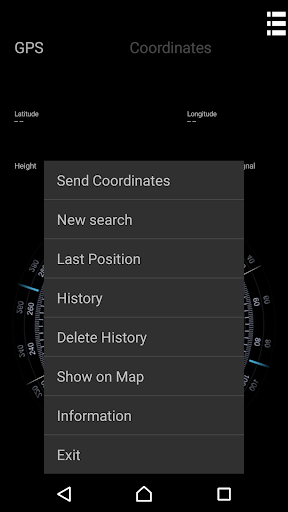
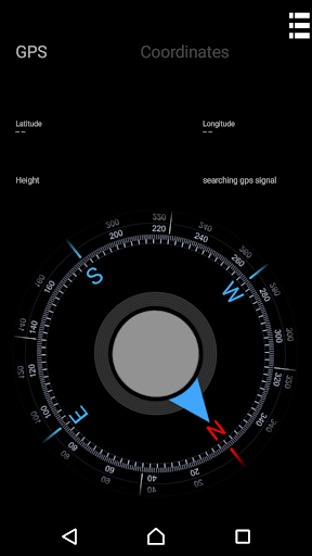
Creates a polygon of area, calculates the area and saves as kml, csv or as a simple text fileCreates a route-perimeter, calculates the distance of points and saves as gpx, csv or as a simple text fileIt contains a coordinate transducer between decimals, degrees and pins87Allows you to view and send the saved files through the applicationIt determines the accuracy of the signal at any moment for best resultsIt contains a compass with azimuth definition and directs to the stored pointExports kml, gpx files to the shared area of the device for opening and viewing with a different application
Social Features
Connect and share with friends and the community.
Fitness Tracking
Track your workouts and monitor your health metrics.
Travel Features
Plan and manage your travels with ease.
See the GPS Coordinates in Action
Get the App Today
Available for Android 8.0 and above